| |
Old Maps of London & Greater London in 1932
Essentials for Local Historians, Genealogists & Family Historians
THERE ARE 109 MAPS IN THIS SERIES
AS A CONTRAST SEE ALSO London 1723-1900 series, London 1888 series, London on CD-ROM sets
MODERN MAPS
LOOKING FOR A DETAILED MODERN ORDNANCE SURVEY MAP OF LONDON? CLICK HERE
BACK TO MAPS HOMEPAGE >
AVAILABLE AS INSTANT DOWNLOADS OR LARGE FORMAT PRINTS
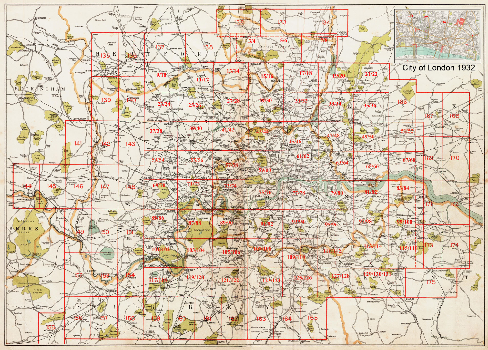
LONDON & GREATER LONDON IN 1932
DETAILS:
The smaller central blocks in the Keymap (below) each show an area of 3 x 2.5 miles, & measure approx. 46 x 41 cm.
The larger outer blocks on the Keymap (below) each show an area of 3¾ x 2¼ miles, and measure approx 58 x 35 cm.
Named items include roads, farms, public buildings*, larger houses, woods, rivers, estates & parks.
Also showing footpaths, ponds & lakes.
ALL RAILWAY LINES AND STATIONS ARE NAMED
*hospitals, libraries, town halls, churches, schools, colleges, museums, gas works, sewage works, etc
|
INSTANT DOWNLOADS:
Full size PDF format maps at 400dpi, with instant secure download at purchase, no delay waiting for an email link. To be viewed in Adobe Reader or similar software. Zoom to 400x in for amazing detail. |
LARGE FORMAT PRINTS:
Large, brand new modern reprints of the originals
Printed on matt white background, but the maps retains the colours & tones of the originals.
PRINTED AREA: 46 x 41 cm or 58 x 35 cm (see listings)
FLAT-SHEET MAPS (not folded)
SENT NEXT WORKING DAY
ROLLED IN A CARDBOARD TUBE |
CLICK THE PANELS ON THE KEYMAP (BELOW) TO VIEW INDIVIDUAL MAPS:
|