OLD TOWNS BOOKS & MAPS
Ordnance Survey 1:25,000 Scale First Series Maps of Kent
1:25,000 = 2½ inches to the mile
.........................................................................................................................................................................
ALTERNATIVELY, CLICK HERE FOR HIGHLY DETAILED MAPS OF KENT
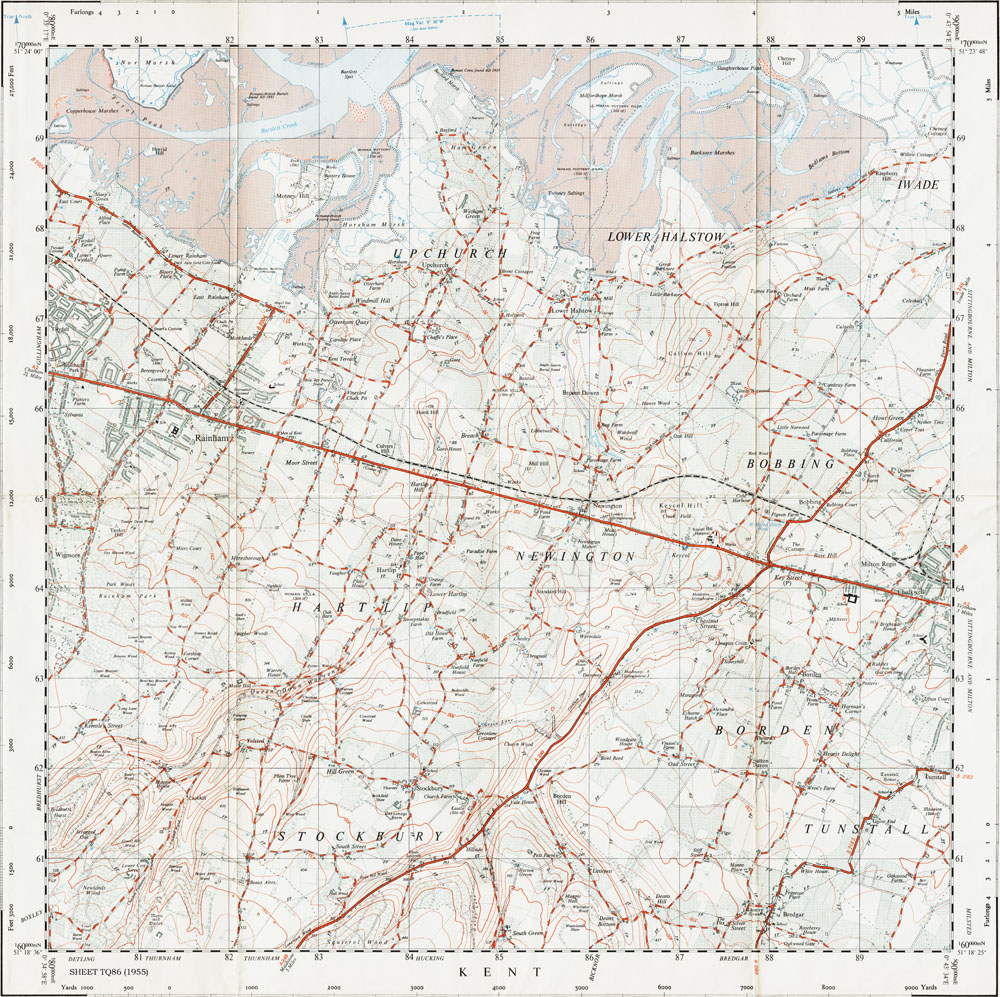
Sheet TQ86
Published 1955
SHOWING:
Gillingham (east), Twydall, Upchurch, Rainham, Lower Halstow, Newington, Hartlip,
Wigmore, Stockbury, Bredgar, Milton Regis, BobbingPDF DOWNLOAD: full size 400dpi scan of the original map measuring 44 x 44 cm, complete with all marks and additions as seen below. Our downloads are high quality with no pixelation even at reasonable high zoom levels (see Sample, below).
For more information about downloads, please read our PURCHASING page.
Why these sheets are especially important to Local Historians -
The date given for this map is publication, not survey date. It was not created from contemporary survey data, but was re-drawn in National Grid format from old 1:10,560 scale (6") maps, often many decades old. So it is possible to locate buildings, field boundaries, roads, railways, etc, which had long disappeared when the map was published.
INSTANT PDF DOWNLOAD £5.99 |
 |
TO VIEW A SAMPLE MAP IN YOUR DEFAULT PDF VIEWER (i.e. Adobe Reader) >> CLICK HERE
You should ensure the "Hand Tool" is enabled, and experiment with the "Zoom" tools.
You will be able to zoom in closer than you will ever need, without loss of quality.